
House explosion site flyover for debris mapping.
To better understand the origin and cause of an explosive event that completely destroyed an isolated house in the Bolognese Apennines, aerial photography taken with the use of a SAPR to support “debris mapping” for the purpose to calculate, based on the size and weight of the debris and their distance from the epicentre of the event, the magnitude of the event itself.
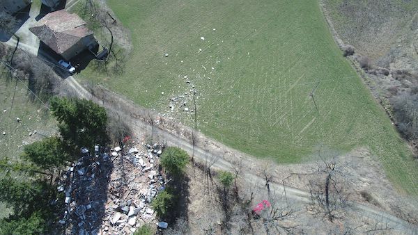
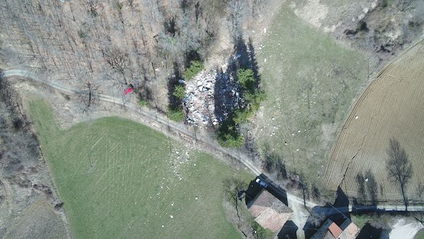
Images taken with a YUNEEC TYPHOON H with on board gimbal camera GCO3+ by s.c.m.